Mapleton developed in a narrow Juniata River corridor where the river, the Pennsylvania Railroad and the ridges surrounding Jack’s Narrows converge. That setting shaped nearly every chapter of the community’s story: the movement of people and freight, the growth of glass-sand quarrying, the placement of streets and businesses, and the recurring danger of floods.
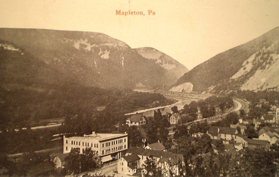
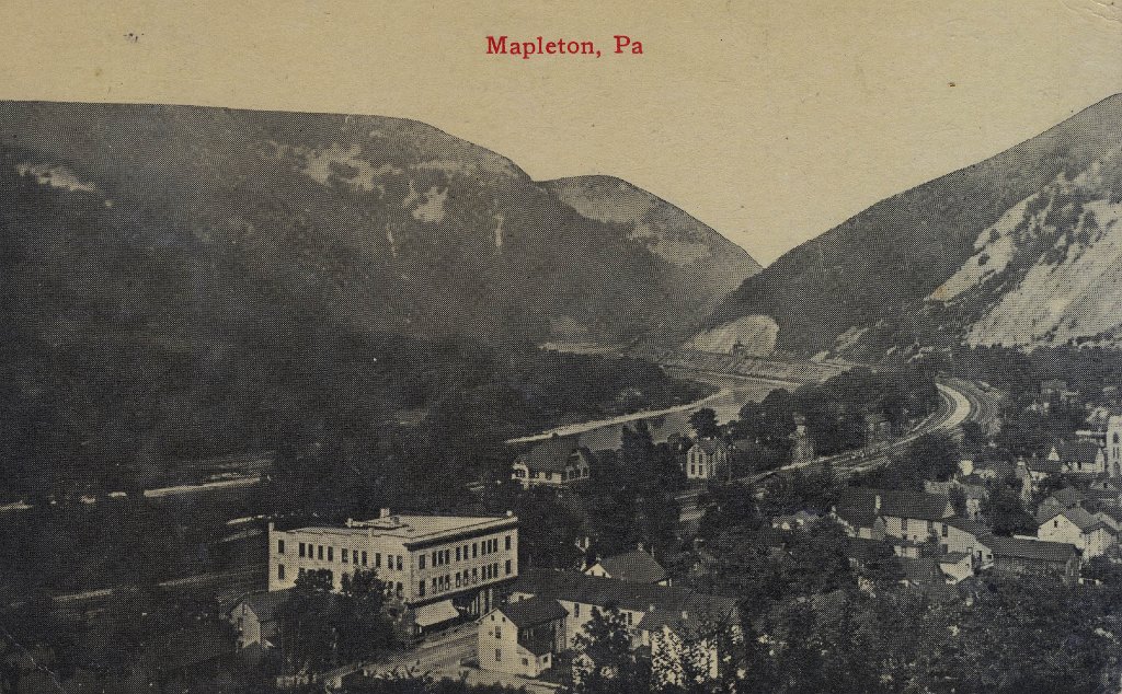
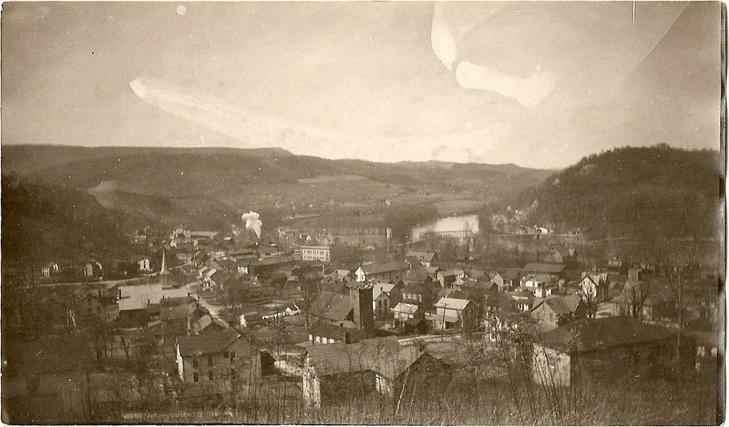
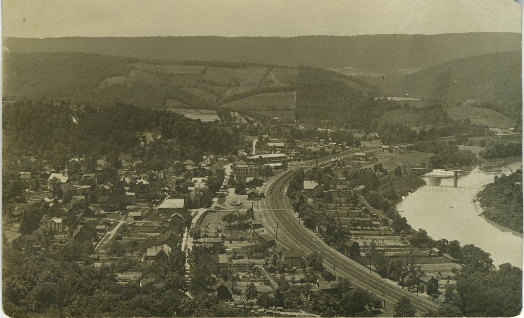
Historic overview of Mapleton, identified in the existing community collection as 1914. The image shows how closely homes, public buildings, the railroad, the river valley and surrounding mountains were connected. Select any photograph on this page to open the larger image.
60
Historic Images
1850s
Commercial Sand Quarrying
1923–24
Keystone Plant Built
38.2 ft
1936 Flood Crest
Landscape
A Mountain Passage
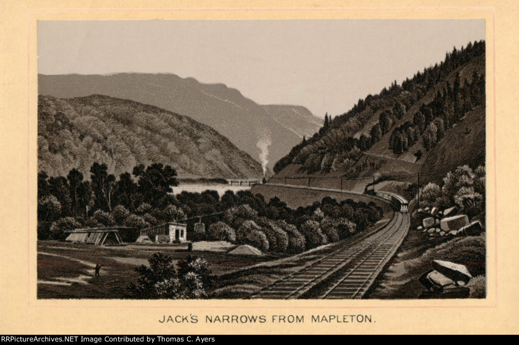
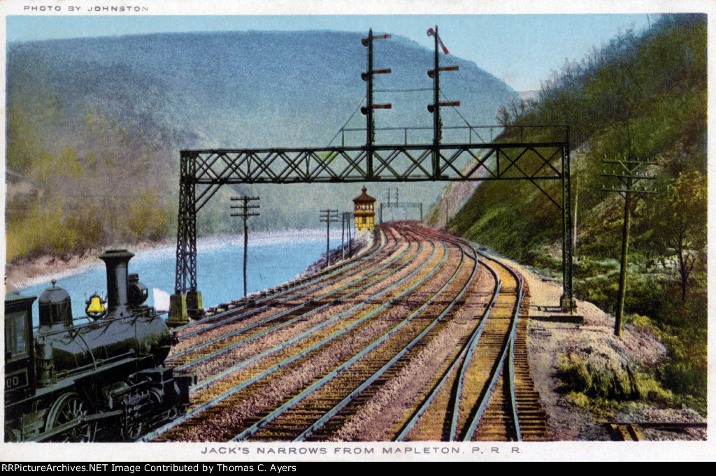
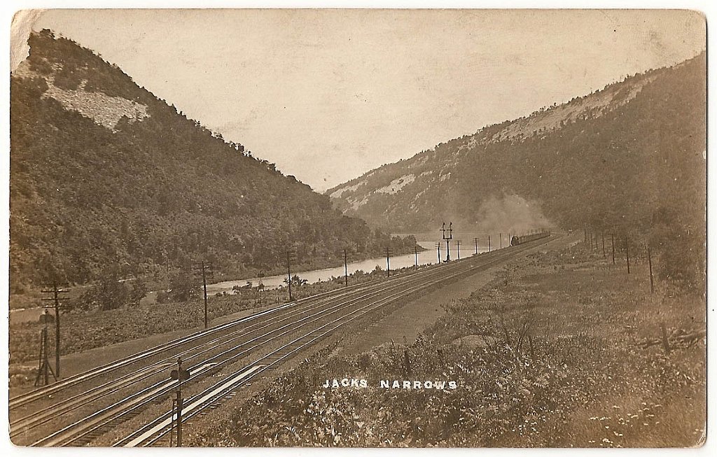
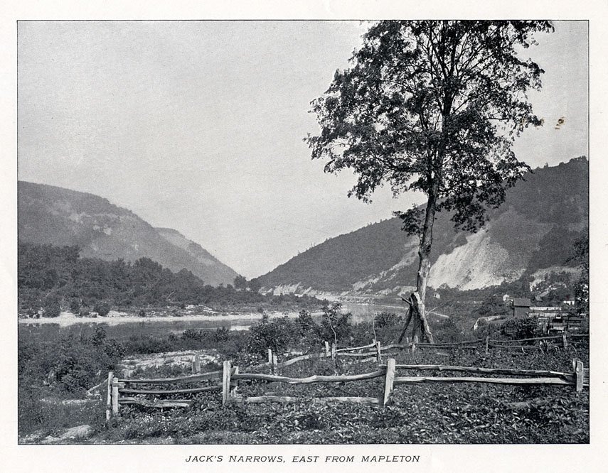
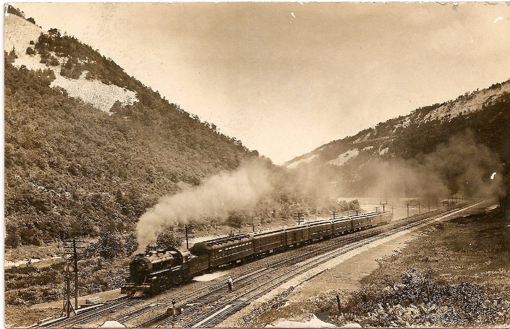
Jack’s Narrows funnels the Juniata River and the historic railroad corridor through the ridges immediately east of Mapleton. Elevated photographs make clear why transportation, housing and industry developed so close together.
Industry
Glass-Sand Country
Commercial development of the area’s high-silica sandstone began in the 1850s. Quarry faces, processing plants, tramways and rail sidings became defining parts of the local landscape.
Community
More Than a Company Town
Mapleton’s photographs preserve houses, churches, stores, hotels, civic buildings, ballfields and gathering places alongside its industrial record.
Evidence
History With Guardrails
Precise claims on this page are tied to published records. Unidentified people, buildings and dates remain labeled as unknown until stronger documentation is found.
Mapleton Through Time
A Working Historical Timeline
This timeline concentrates on events that can presently be supported by industrial surveys, river records and the community photograph collection. It will expand as borough, church, school and family records are documented.
1850s
Commercial glass-sand quarrying develops
A Huntingdon County industrial survey reports that commercial development of glass-sand quarries near Mapleton began during the 1850s.
Late 1800s
Rail access accelerates growth
The completion and expansion of the Pennsylvania Railroad corridor stimulated both industrial development and the growth of the community around Mapleton Depot.
1902
Pennsylvania Glass Sand Company is organized
Lewistown investors organized the company and consolidated sand interests in the Mapleton and Mifflin County area.
1923–1924
The Keystone plant is constructed
The surviving industrial complex documented by the county survey was built in 1923–24 and later operated under the U.S. Silica name.
March 18, 1936
The Juniata reaches its flood of record
The Mapleton Depot river gauge recorded a crest of 38.2 feet and an estimated flow of 165,000 cubic feet per second.
June 23, 1972
Hurricane Agnes floods Mapleton
The Juniata crested at 33.07 feet at Mapleton Depot, more than 13 feet above the present 20-foot flood stage.
1983–1986
Jack Wise’s crosses rise above Mapleton
After surviving cancer, Wise erected the first cross in 1983 as an expression of faith and thanks. The second followed in 1984, the third in 1985, and the family dates completion of the project to 1986. Read the documented story.
Today
The landscape remains a historical record
The river corridor, rail line, quarry scars, industrial buildings, three crosses and surviving community photographs preserve the physical evidence of Mapleton’s past.
The Industry That Defined the Landscape
Glass Sand, Quarries and the Keystone Works
A county industrial inventory identifies a long succession of operations in the Mapleton area, including Southside, Glenndower, Phillips Sand, Juniata White Sand, Franklin, Columbia, Keystone, Westbrook, Pittsburgh White Sand and Empire. Company names and ownership changed, but the basic system remained recognizable: rock was quarried on the slopes, moved by tramway or small locomotive, crushed and washed, dried and screened, then transferred to the larger railroad network.
From Rock Face to Rail Car
The industrial inventory documents crushers, milling and washing buildings, drying and screening facilities, pulverizing mills, a foundry-sand plant, settling tank, pump house, machine shop and storage silos. The photographs below show the human side of that process: quarry crews, horse teams, rail cars and “dinky” locomotives.
The Keystone Plant
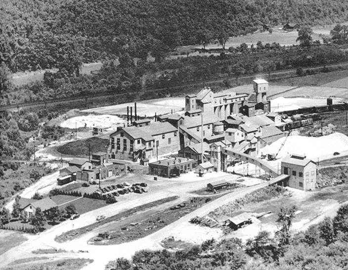
The Keystone complex was constructed in 1923–24 north of the Juniata River, across from Mapleton in Brady Township. Its location joined quarry resources to the Pennsylvania Railroad and became the surviving industrial anchor in the county survey.
A Corridor of Movement
Railroad, River and Jack’s Narrows
The Pennsylvania Railroad did more than pass Mapleton: it connected the sand works to national markets and helped organize the physical shape of the borough. Postcards labeled “Mapleton Depot” preserve the town’s railroad identity, while views through Jack’s Narrows show the tracks sharing a narrow passage with the Juniata River. Within the quarries, temporary track, horse-drawn tram cars and small industrial locomotives bridged the distance between the rock faces and processing plants.
Life Beyond the Quarry
Streets, Stores and Community Landmarks
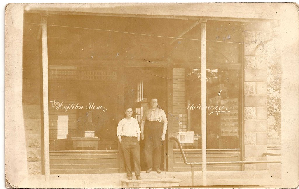
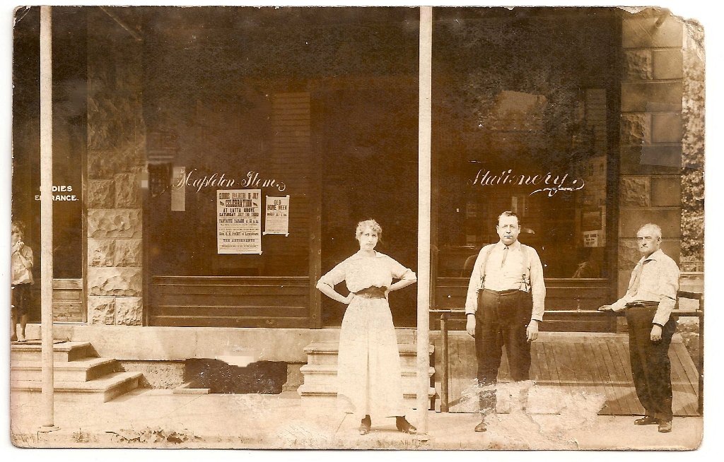
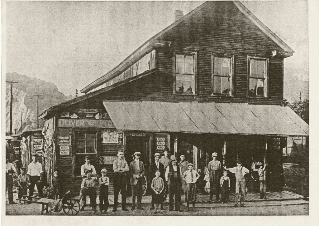
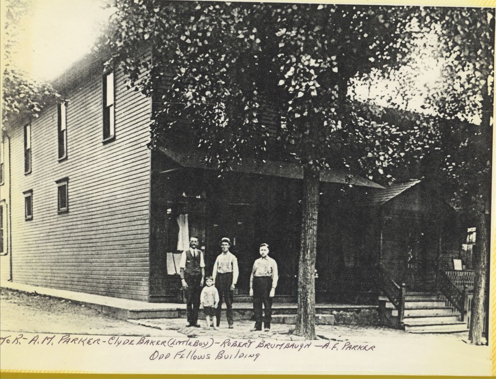
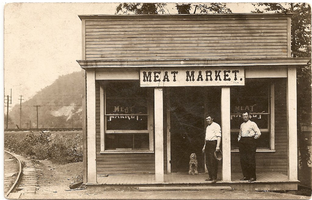
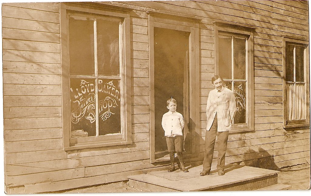
Mapleton’s business and street photographs widen the story beyond industrial production. The surviving collection records the Mapleton Item office and stationery shop, Parker businesses, a meat market, a barber shop, the Odd Fellows building, the Hotel Clairndon, residential streets and local recreation grounds. Where a storefront sign or handwritten caption identifies a place, that evidence is retained; where the evidence is incomplete, the caption says so.
Community History
The H. O. Andrews Feed Mill
Mapleton’s industrial heritage includes agricultural processing as well as glass sand. The National Park Service identifies the H. O. Andrews Feed Mill on West Main Street and records 1914 as its significant year. It entered the National Register of Historic Places on March 20, 1990, with significance in industry.
The mill adds a different kind of work to Mapleton’s story: processing and supplying agricultural products. Its National Register record provides a firm starting point for a fuller history of the building, its machinery and the people who worked there.
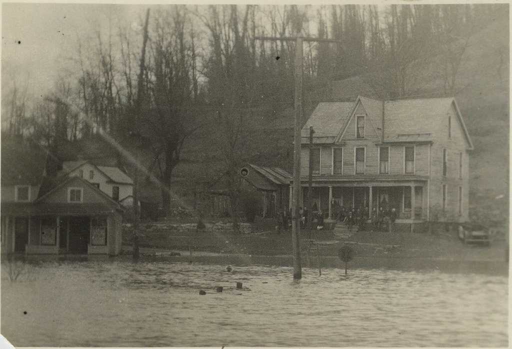
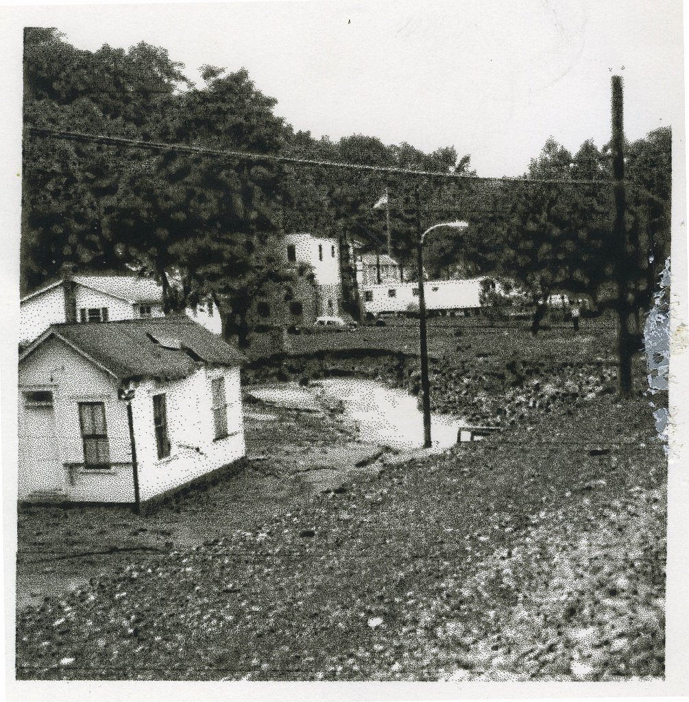
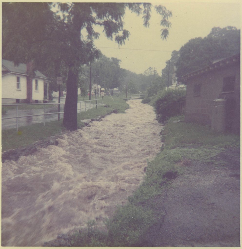
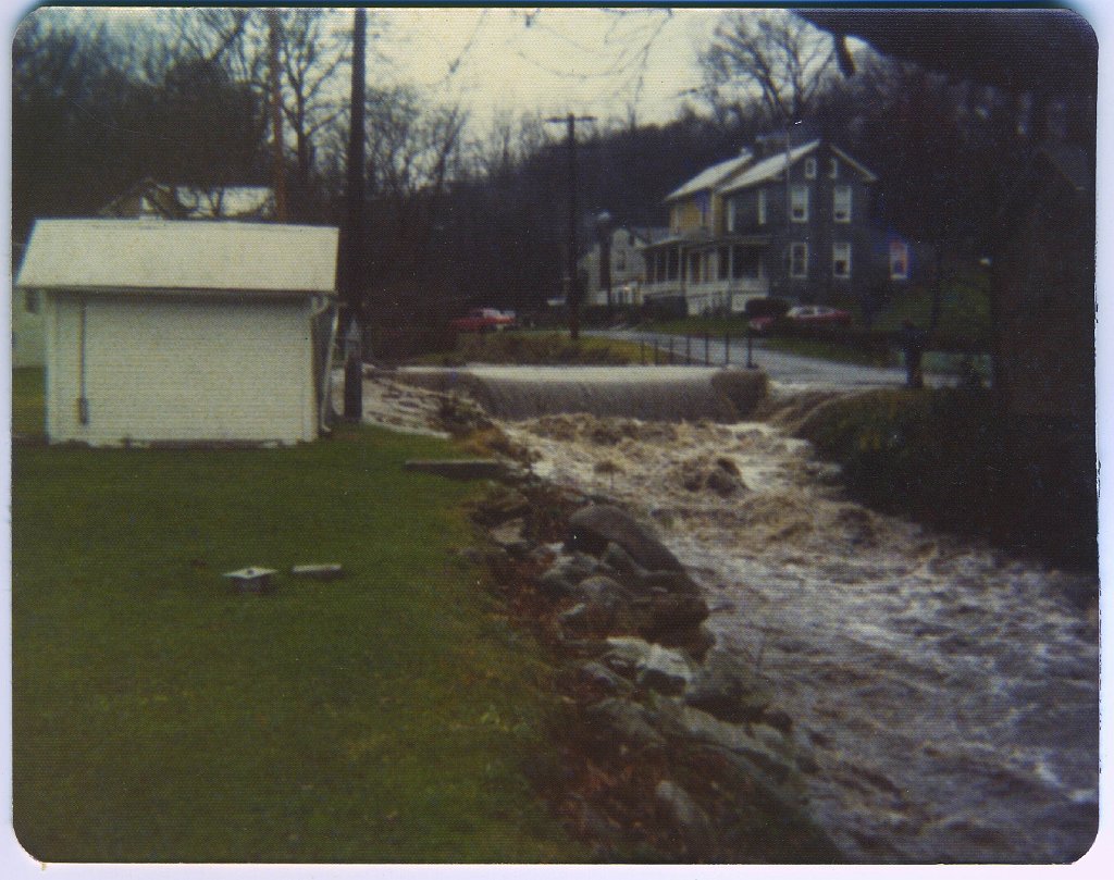
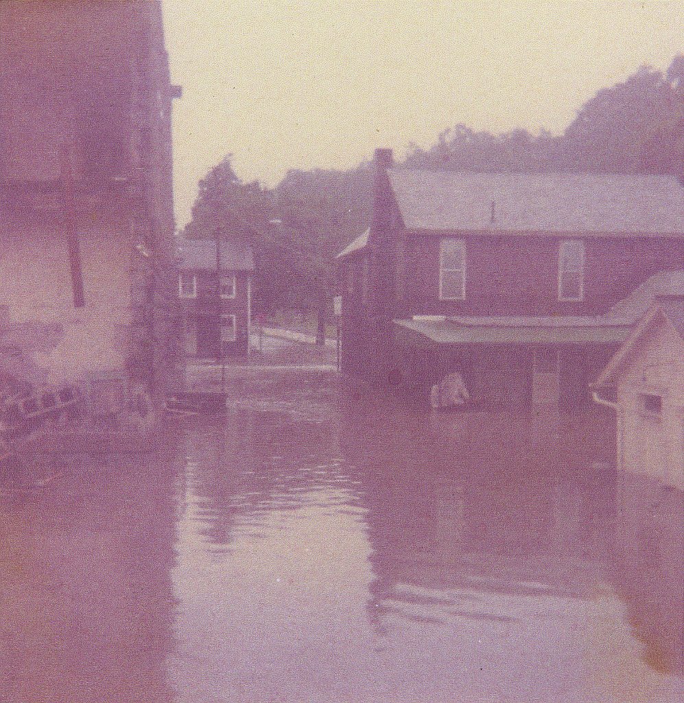
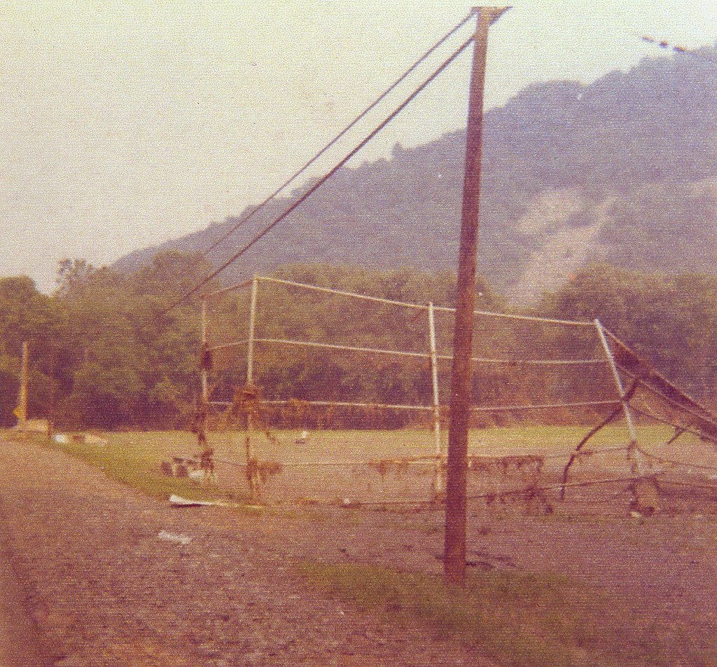
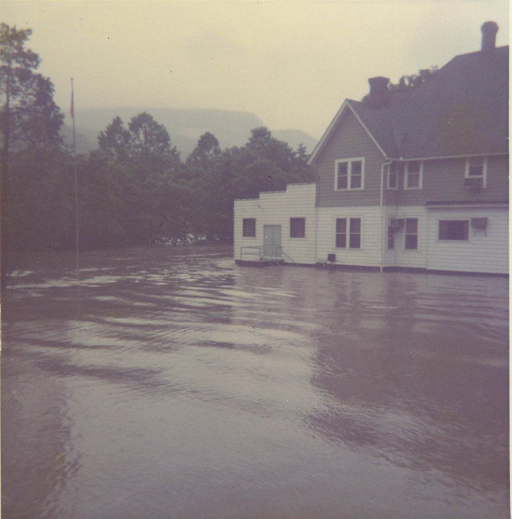
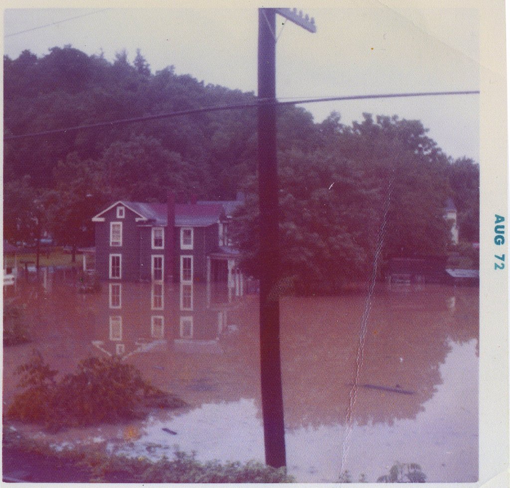
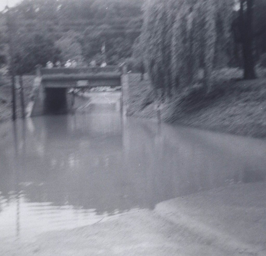
The Juniata River gauge at Mapleton Depot has operated since 1936. Its highest recorded crest came on March 18, 1936, when the river reached 38.2 feet with an estimated flow of 165,000 cubic feet per second. Hurricane Agnes produced the second great documented flood on June 23, 1972: 33.07 feet and approximately 125,000 cubic feet per second. Community photographs show the consequences at Scrub Run, neighborhood properties, the ballfield, American Legion area and a railroad underpass.
Research note: The 1936 and 1972 crest figures come from National Weather Service river records. The industrial chronology and plant layout come from the Huntingdon County industrial inventory. Photo captions are intentionally more cautious when the image itself is the only available evidence.
The Photographic Record
Explore Mapleton’s 60-Image Archive
The collection is organized by subject so visitors can move from the industrial story into streets, commerce, landmarks, transportation and floods. Select any image to open the larger file.
The Sand Works
From Rock Bank to Processing Plant
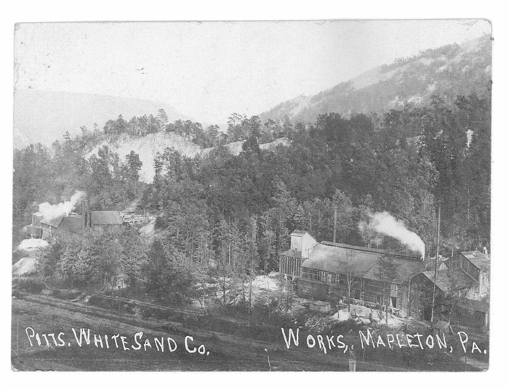
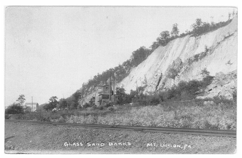
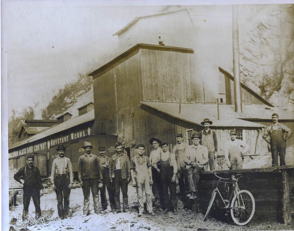
Several photographs identify the Pittsburgh White Sand Company or the Keystone Works directly. Together they show processing buildings, rail cars, locomotives, crews, and the pale rock deposits that defined the industrial landscape.
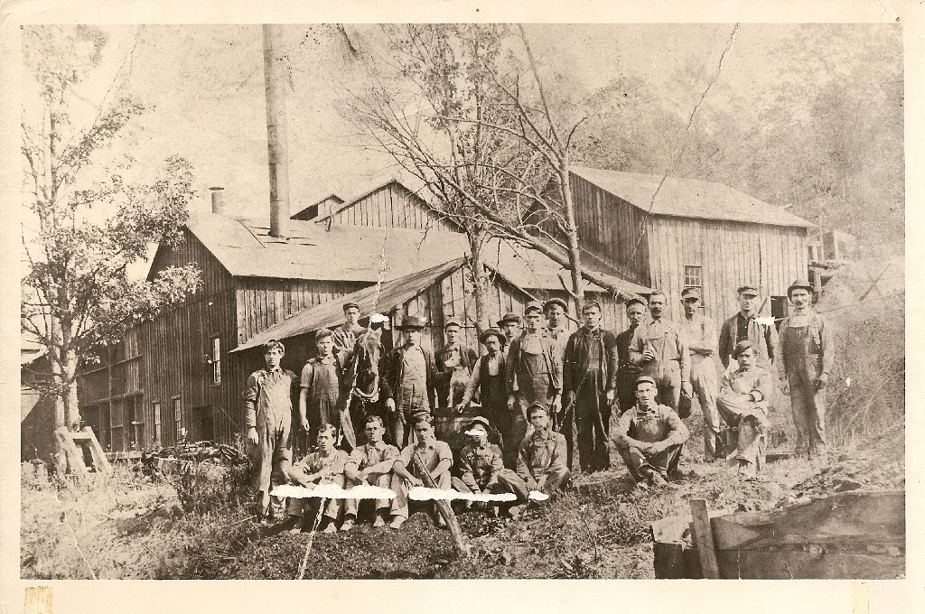
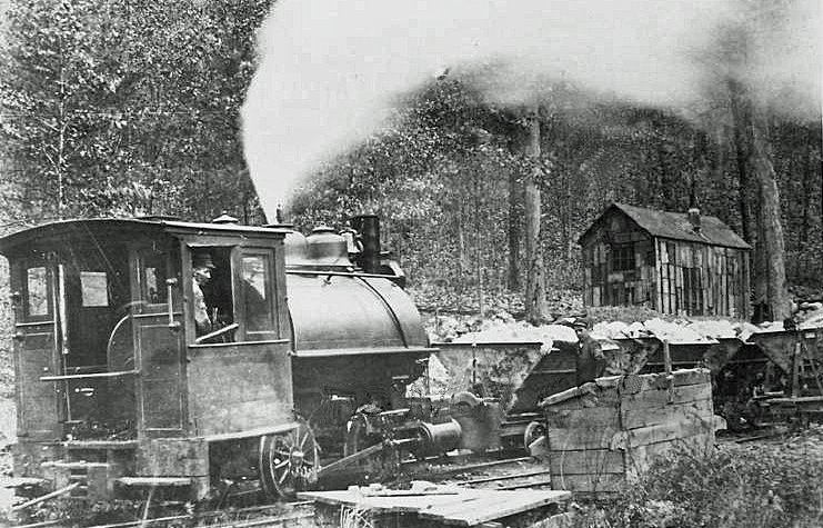
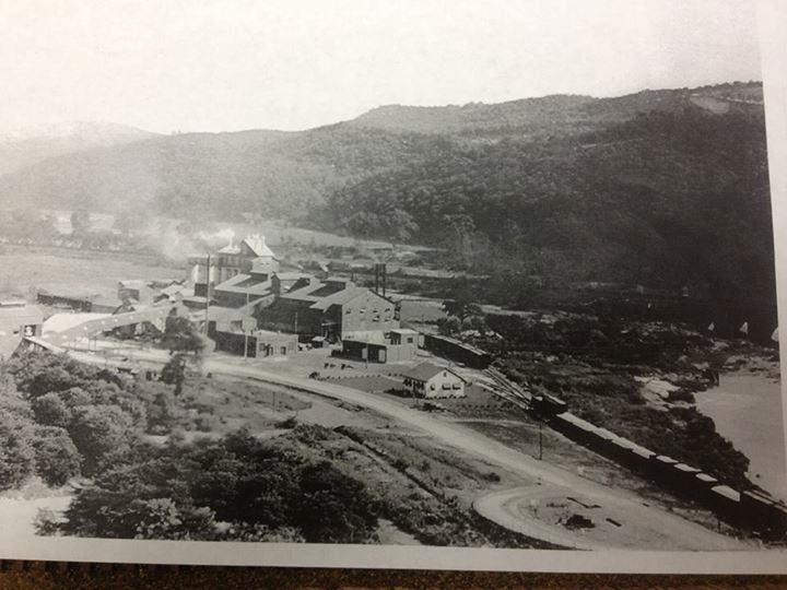
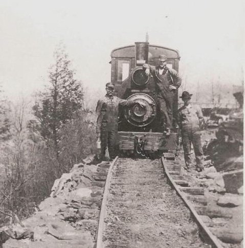
Pittsburgh White Sand Company works, Mapleton. The identification is printed on the original postcard.Glass-sand banks and processing buildings. The postcard is labeled “Mt. Union, Pa.”; its exact relationship to the Mapleton works remains to be verified.Workers and rail cars at the Glass Sand Company’s Keystone Works; the company name is visible on the original rail car.Sand-works crew posed in front of the plant buildings. Names and date have not yet been identified.A small steam locomotive at the sand works. Exact date and personnel remain unidentified.Elevated view of the sand plant near Mapleton from the existing BrickTownPA collection.Mapleton sand plant, identified in the existing collection as a 1940s view.
At the Rock Face
The Quarry Crews
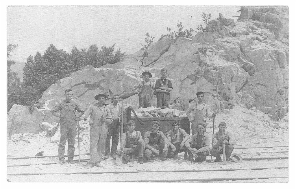
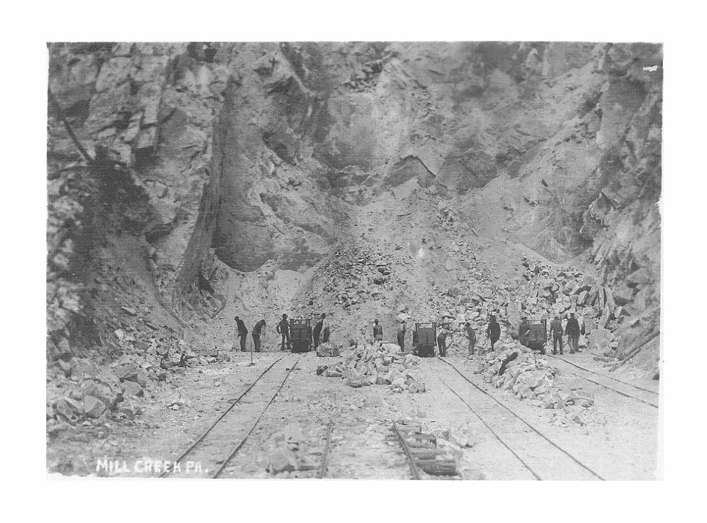
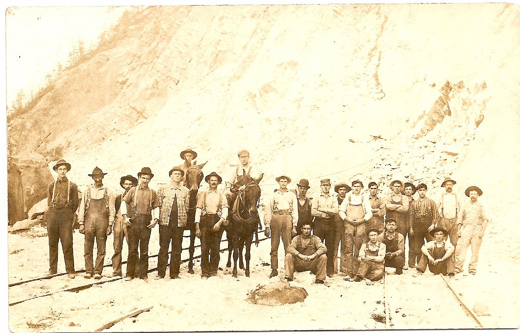
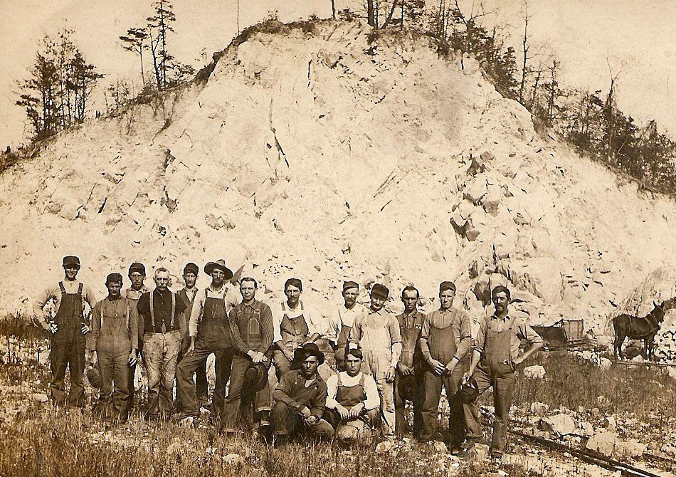
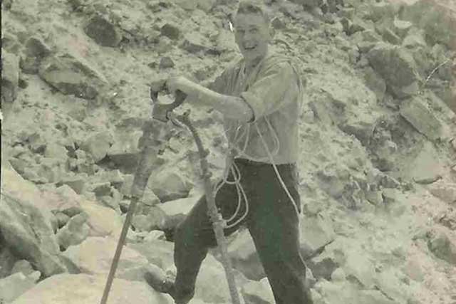
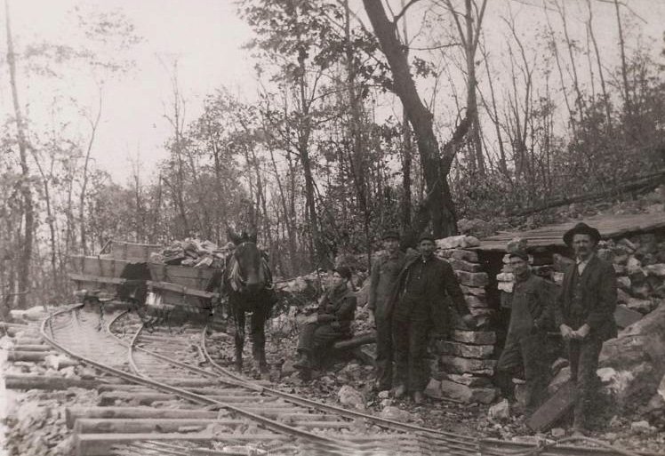
The quarry photographs place the workers at the center of the story. They record hand tools, horses, small rail cars, exposed rock, and crews assembled together during a demanding era of industrial labor.
Quarry crew with a loaded industrial rail car. Names, date, and precise quarry have not yet been identified.Photograph labeled “Mill Creek Pit.” Its precise connection to the Mapleton operations remains to be documented.Quarry crew and horses at an exposed rock face. Exact location and date are not yet documented.Quarry crew at a rock bank with a horse and industrial rail car.An individual quarry worker with his tools. His name, location, and date remain unidentified.
Industrial Transportation
Dinky Locomotives and Tramways
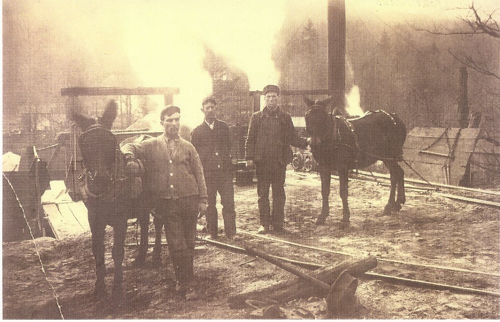
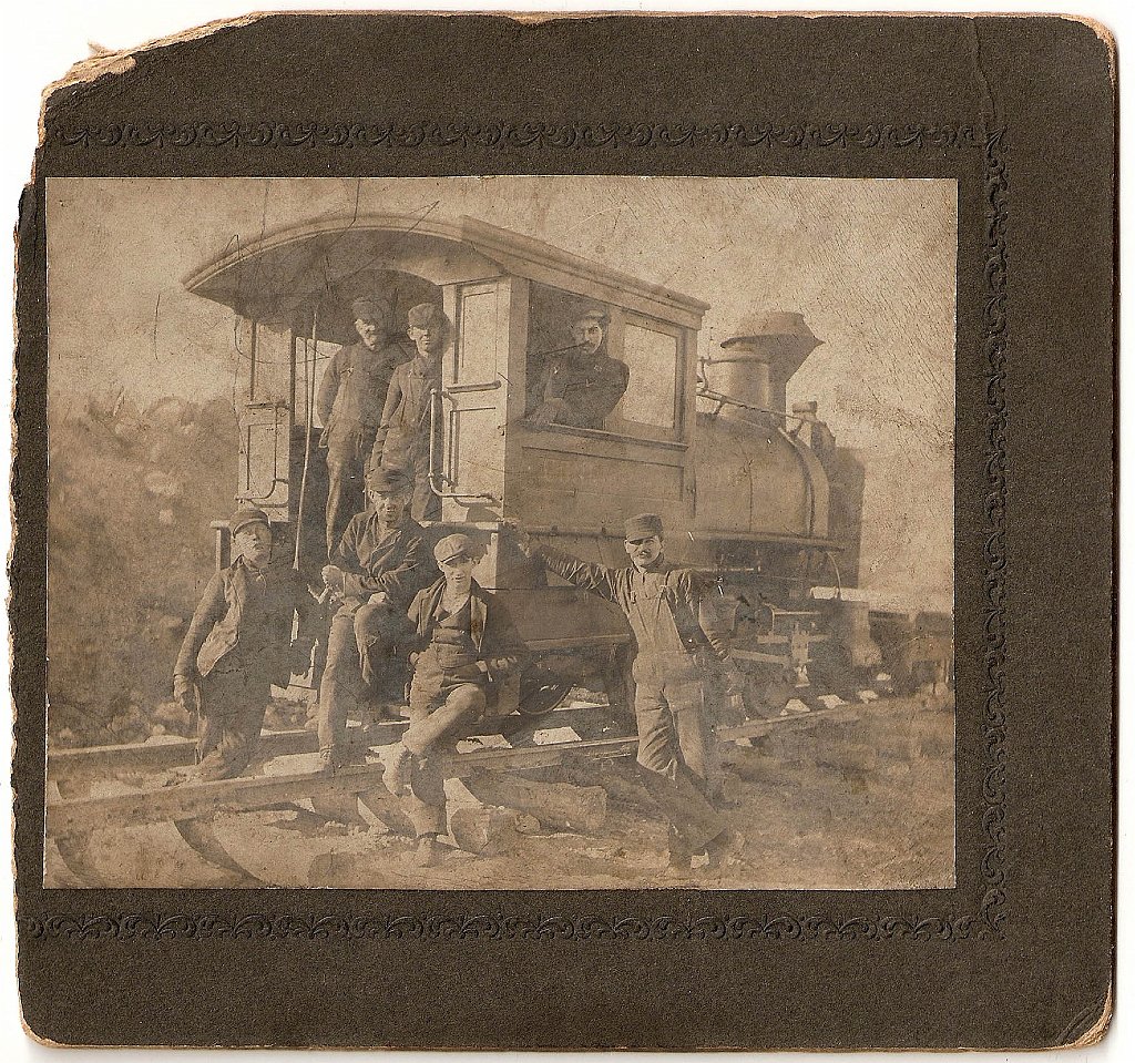
Small locomotives, temporary track, horse teams, and tram cars connected the working rock faces with the processing plants and larger railroad network. These photographs preserve the people as well as the equipment that kept the system moving.
Dinky locomotive and crew on industrial track.Horse-drawn quarry tram and workers on branching track.Workers, horse teams, and industrial track within the plant complex.Mounted photograph of a dinky locomotive and six crew members. Names and date remain unidentified.
Where People Lived
Early Streets of Mapleton
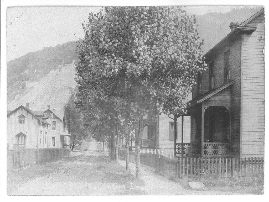
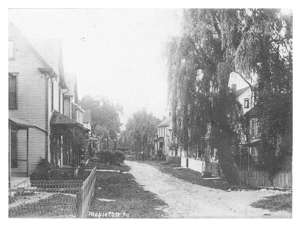
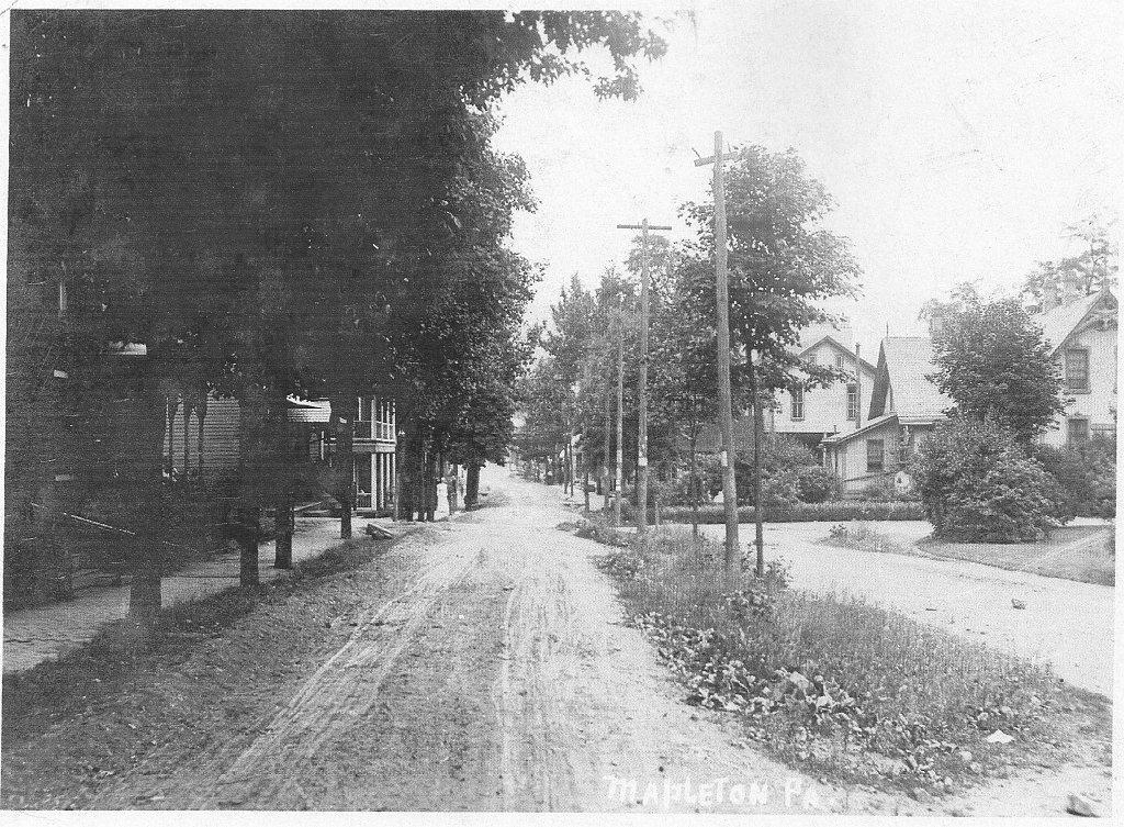
Three postcard views turn from the workplace to the borough itself, recording unpaved streets, porches, fences, shade trees, utility poles, and the mountain landscape surrounding the homes.
Residential street in Mapleton with an exposed rock face visible beyond the houses.Early Mapleton residential street, identified by the handwritten title on the original image.Early view along Main Street, Mapleton.
Commerce and Daily Life
Stores, Markets and Local Services
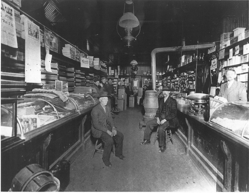
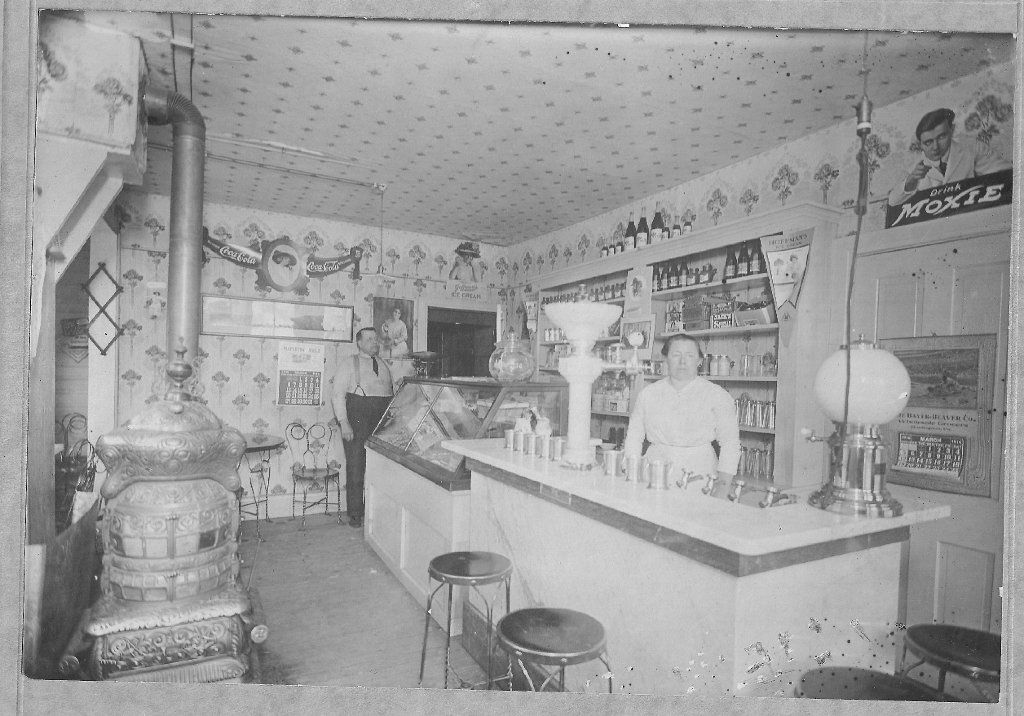
Storefronts and interiors reveal another side of Mapleton’s history. The photographs preserve the Mapleton Item office and stationery shop, Parker businesses, an early general store, a meat market, and a barber shop. Names and dates are included only when they appear on an image or in the supplied collection description.
Two men outside the Mapleton Item and stationery storefront. Their names and the date remain unidentified.The Mapleton Item storefront with one woman and two men. The people and date remain unidentified.Interior of Parker’s store, as identified in the supplied collection. The shelves, cases, stove, and gathering customers show the store’s role in everyday community life.Parker store interior, identified in the collection as March 1916, with a soda fountain, display case, stove, and two attendants.Early general store and community group. The visible sign has not yet been read clearly enough to confirm the business name.Outside the Odd Fellows building. The handwritten identification names, from left, A. M. Parker, Clyde Baker (the child), Robert Brumbaugh, and A. F. Parker.Two men and a dog outside an early meat market beside the railroad. The proprietor, date, and precise location remain unidentified.Early barber shop with a barber and young boy. The painted window lettering is visible, but the names and date still need documentation.
Landmarks and Workplaces
Hotel Clairndon, the Tannery and Other Buildings
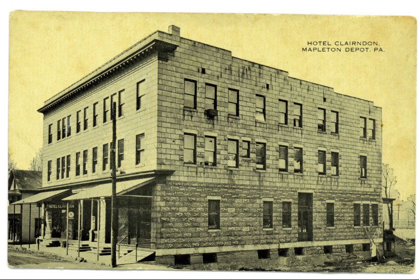
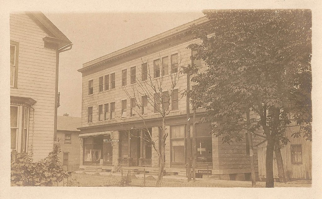
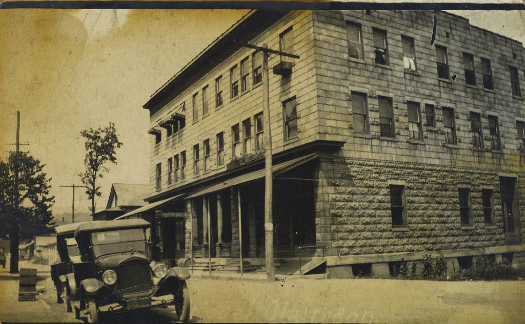
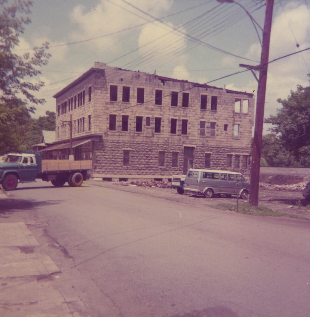
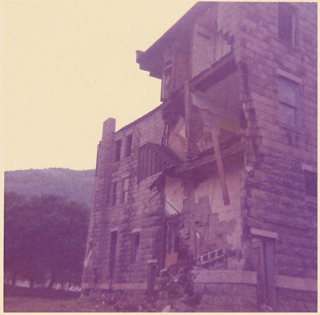
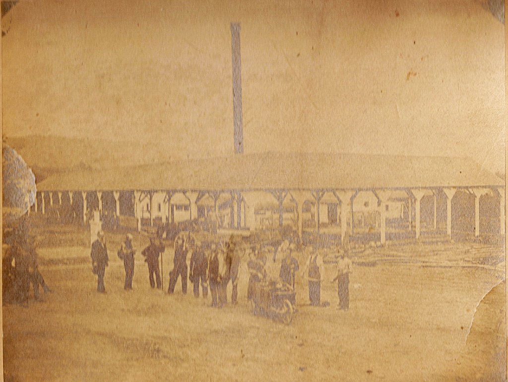
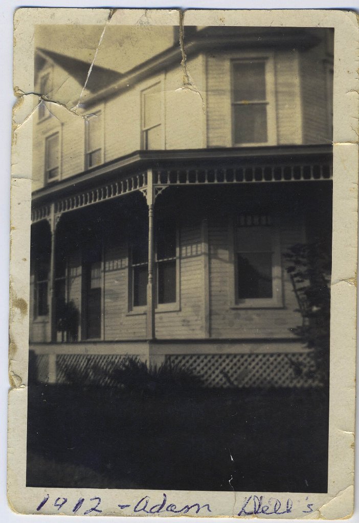
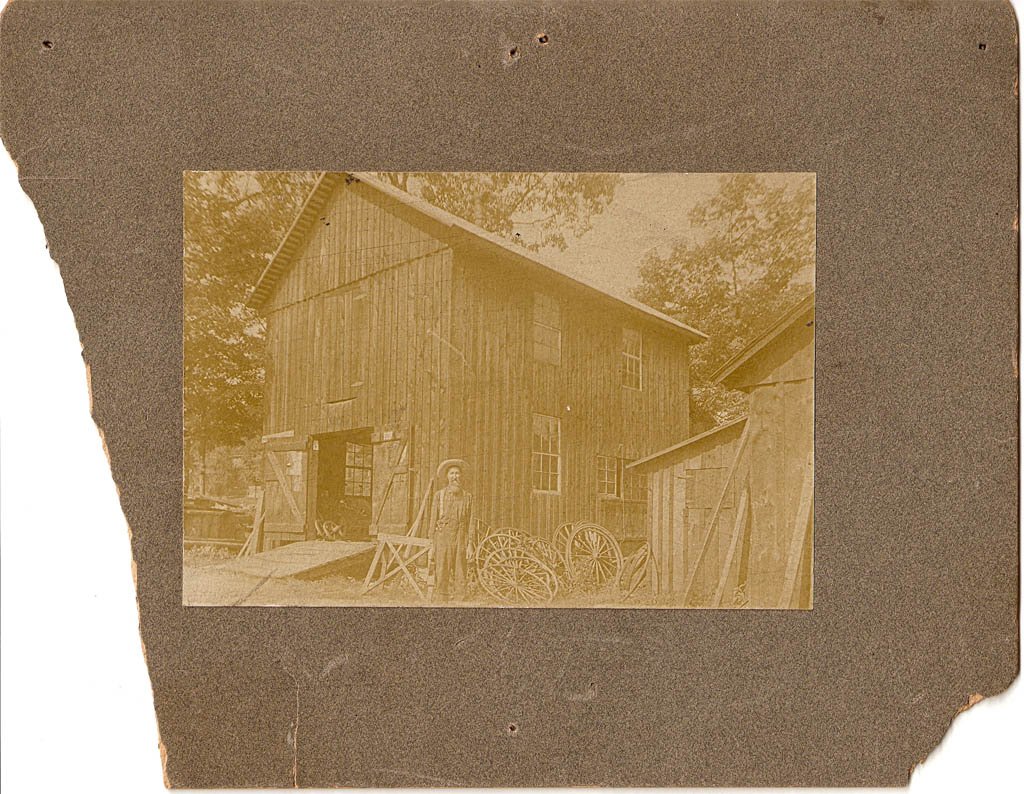
The Hotel Clairndon appears repeatedly in the collection, from early postcard views to photographs identified as showing later damage. Other images preserve the 1872 tannery, a house associated with Adam Dell, and an unidentified workshop. The historical spelling “Clairndon” is retained because it appears directly on the hotel photographs.
Hotel Clairndon, Mapleton Depot, as labeled on the original postcard.Street view of the Hotel Clairndon. The hotel’s sign is visible near the entrance.Hotel Clairndon with an early automobile parked along the street.Later condition of the Hotel Clairndon. The supplied filename associates this view with train-wreck damage, but the date and circumstances still require a published source.Close view of major damage to the Hotel Clairndon. The collection associates it with a train wreck; further documentation is needed before adding a date or narrative.Workers at a tannery, identified in the supplied collection as Mapleton in 1872. The operator and exact site remain to be documented.House identified on the original photograph as “Adam Dell’s, 1912.” Its street location has not yet been verified.Unidentified wooden workshop with a man and wagon wheels. The building, person, date, and location remain unknown.
River, Railroad and Mountain Passage
Mapleton and Jack’s Narrows
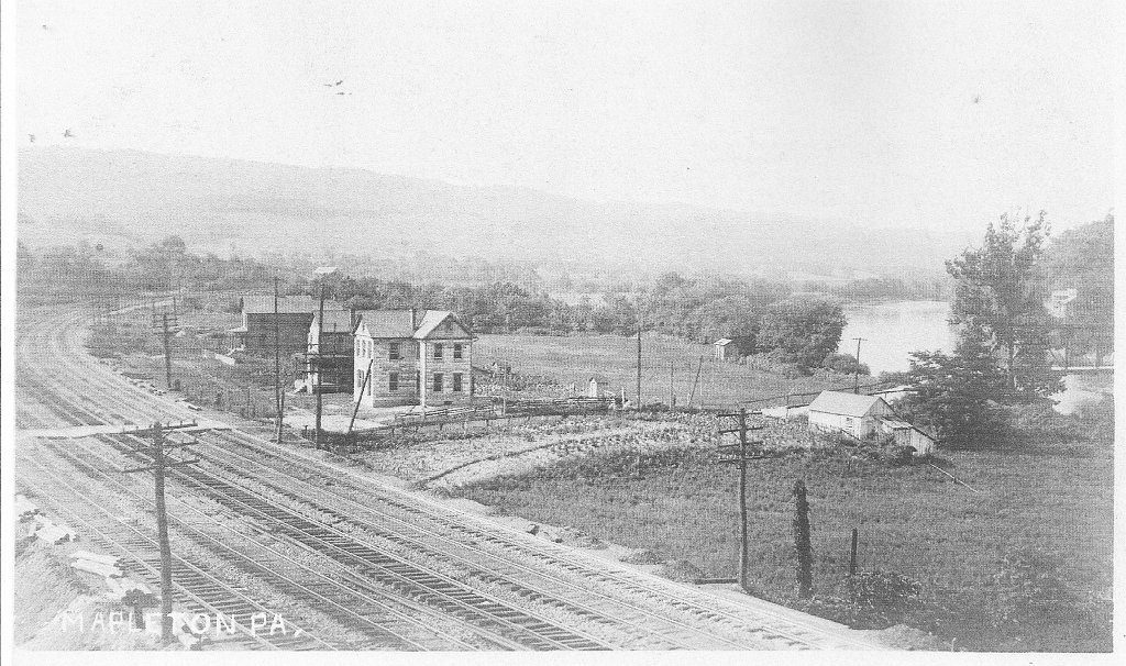
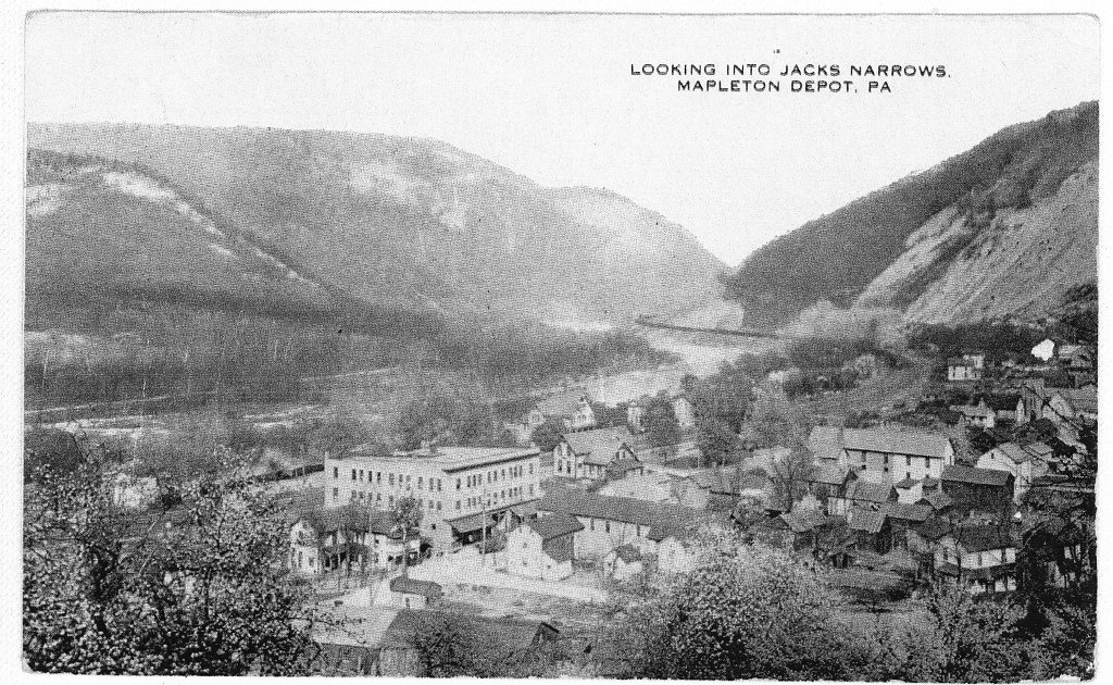
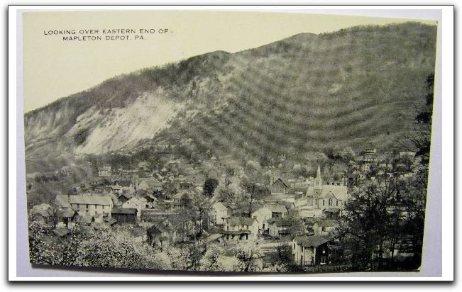
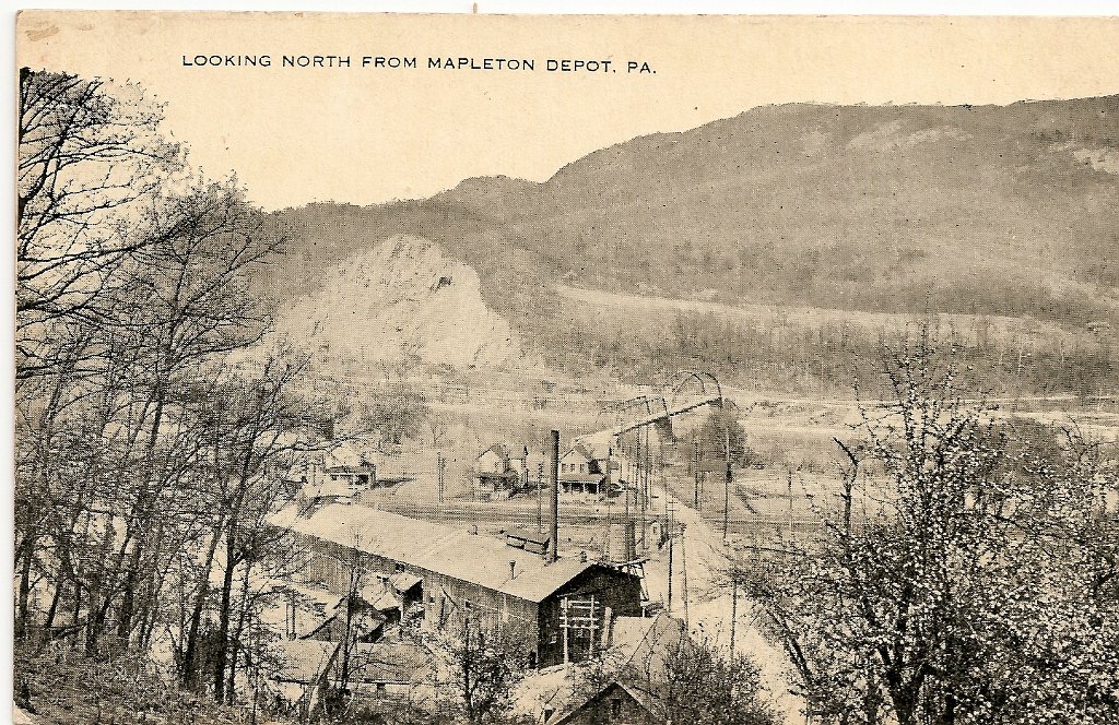
Mapleton sits where the Juniata River, the railroad, and the surrounding ridges converge near Jack’s Narrows. These postcards and elevated views show how closely the borough’s homes, industrial sites, transportation corridor, river, and mountain landscape were connected.
Since 1983, the Three Crosses of Mapleton have stood on the rocky overlook above town, a landmark created by Jack Wise and maintained by his family and friends.
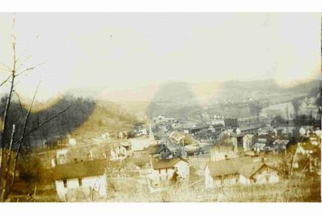
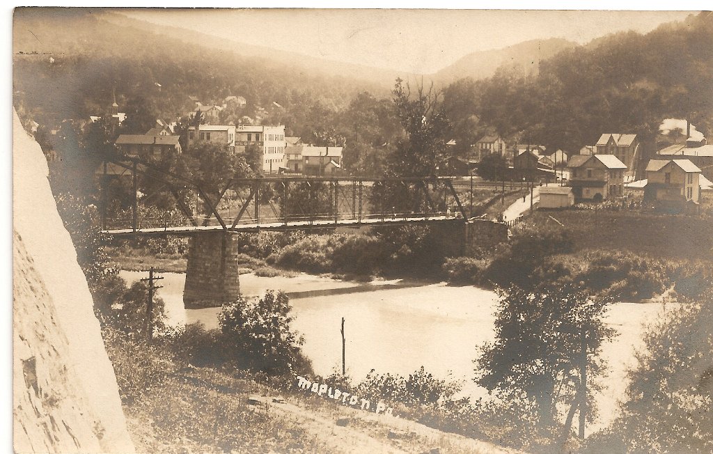
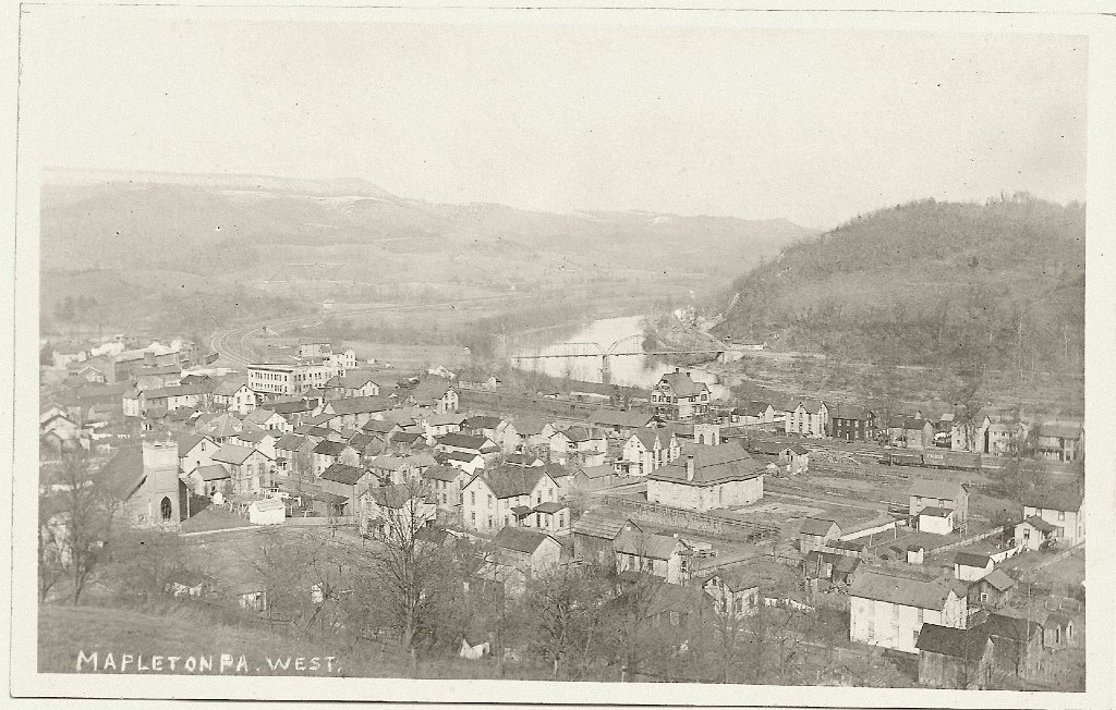
“Jack’s Narrows from Mapleton,” an illustrated view showing the railroad and river corridor. Image credited on the scan to Thomas C. Ayers through RRPictureArchives.NET.Color postcard of the Pennsylvania Railroad through Jack’s Narrows from Mapleton. The scan credits Thomas C. Ayers through RRPictureArchives.NET.Postcard overview of Mapleton looking toward Jack’s Narrows.Mapleton viewed from the east. Date and photographer remain unidentified.Railroad tracks and a train through Jack’s Narrows beside the Juniata River.High panoramic view of Mapleton, its railroad corridor, bridge, and the Juniata River.Hillside view overlooking Mapleton. Date and precise vantage point remain unidentified.“Jack’s Narrows, East from Mapleton,” as titled on the original printed image.West side of Mapleton, with railroad tracks, river, cultivated lots, and buildings. The original image is labeled “Mapleton, Pa.”“Looking into Jack’s Narrows, Mapleton Depot, Pa.,” as titled on the original postcard.“Looking over eastern end of Mapleton Depot, Pa.,” as titled on the original postcard.“Looking north from Mapleton Depot, Pa.,” as titled on the original postcard.Steam passenger train moving through Jack’s Narrows. The date, locomotive, and photographer remain unidentified.Historic truss bridge across the Juniata River at Mapleton. The date and bridge history remain to be documented.Elevated view labeled “Mapleton, Pa. West,” showing the town, church, railroad, river, and bridge.
1936 and 1972
Floods Across Generations
Two separate flood events are represented here. One photograph is identified with the widespread 1936 flood. Eight additional images document Mapleton during the Hurricane Agnes flooding of 1972, including Scrub Run, neighborhood properties, the ballfield, American Legion area, and a flooded underpass.
Mapleton-area flooding in 1936, as identified in the supplied collection. The street and buildings have not yet been precisely identified.Flood damage in Mapleton during Hurricane Agnes, 1972. Exact location remains unidentified.Scrub Run rushing between neighborhood properties during Hurricane Agnes, 1972.Floodwater at the Scrub Run dam or retaining structure during Hurricane Agnes, 1972.Flooding at the location identified in the collection as Parker’s during Hurricane Agnes, 1972.Damage at the Mapleton ballfield during Hurricane Agnes, 1972.Flooding at the American Legion area during Hurricane Agnes, 1972.Mapleton flooding in a photograph stamped August 1972. The building has not yet been identified.Flooded underpass during Hurricane Agnes, 1972.
Sources and Documentation
Huntingdon County Industrial Site Survey — commercial quarry development, company succession, Pennsylvania Railroad influence, construction of the Keystone plant and the documented plant layout.
The 60-image Mapleton community collection reproduced on this page — visual evidence for streets, storefronts, hotel, quarries, tramways, railroad corridor and flood damage. Identifications that are not printed on an original image remain provisional.
About this collection: These photographs were supplied to BrickTownPA as a Mapleton-area collection. Captions distinguish information printed directly on the originals from details that still need verification. No photographer, donor history, or exact date has yet been documented for most images. If you can identify a worker, street, building, quarry, company, or date, please send a correction or additional context.